Map of Eltham and Kidbrooke, 1746

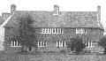
Eltham was a substantial village in the mid-18th century. Its economy would have been enhanced by its position on the road to Maidstone and by its elevated and "healthy" environment.
To the south-west of the high street are the remains of Eltham Palace (King John's Court). Eltham Palace was an important medieval royal house enhanced by convenient access to the royal territories in France.
Not favoured by the Tudors, the great Plantaganet palace was ransacked during the Commonwealth period and the three hunting parks stripped of their timber. Edward IV's Great Hall became a neglected farm building.
Proper restoration of the Great Hall and the moat bridge did not take place until Stephen and Virginia Courtauld leased the palace site in the 1930's. Adjacent to the medieval hall they built themselves a stunning Art Deco mansion. The palace, managed by English Heritage, is a very popular visitor attraction today.
Click on the map for an enlarged image or click here for a larger, readable image (slower download).
Engraved by Richard Parr, surveyed and published by John Rocque, 1746