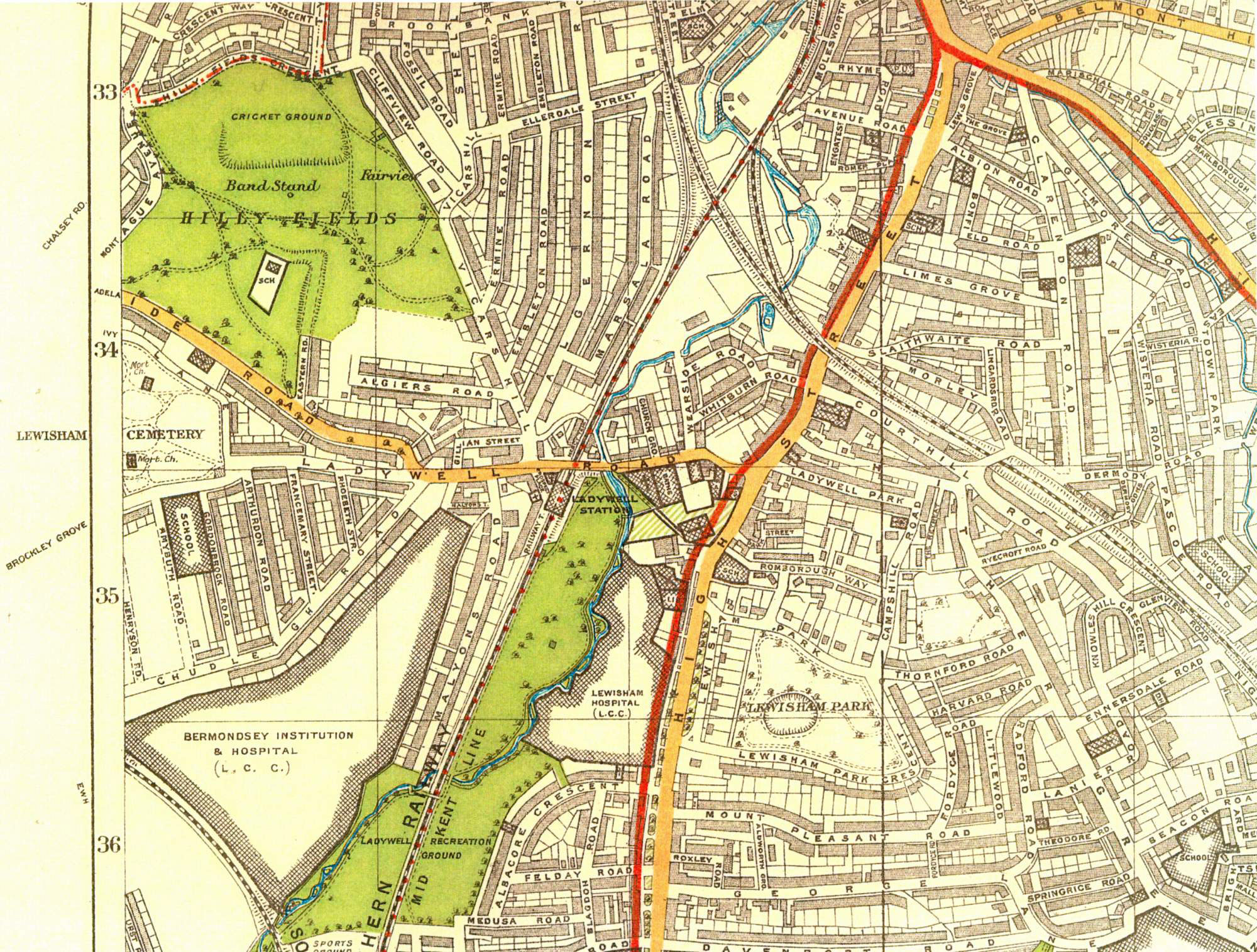
Map of Ladywell, Lewisham, 1930

The main landowners in the Ladywell area were the Vicar of Lewisham and the
Corporation of London, for the Bridge House
Estate.
The vicar's glebe to the north of
the village was built over from the 1880s.
Bridge House Farm to the south was
demolished c.1899, and the roads on its site
(Chudleigh, etc.) built from the early years of
the 20th century.
The St Olave's Bermondsey workhouse was built on the fields of Slagrave Farm and opened in 1900. Development was nearly complete by 1930.
Click on the map for an enlarged image or click here for a larger, readable image (slower download).
London County Council map
1930.


