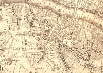
Borough and Bankside 1769
Although only 25 years separate the original edition of Roque with this revision, the changes that had taken place were to have a tremendous impact on Southwark.
Blackfriars Road, Borough Road and other boulevards leading to St Georges Circus have been laid over the waste of St George's Fields and the ancient street pattern has been replaced with the confident sweep of a town planner's vision of the future, not the past.
New building took place on the northern section of Blackfriars Road, but at rather a later date on St George's Fields. Note the ribbon development along Blackman Street (now the northern portion of Borough High Street), Kent Street and Long Lane.
Map surveyed by John Roque 1741 - 1745 and engraved by Richard Parr. Published by Edward Stanford, 1769.
Click on the map above for an enlarged image or click here for a larger, readable image (slow download).


